


Precinct 17, Lyon County, Kansas
About
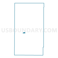
Outline

Summary
| Unique Area Identifier | 585745 |
| Name | Precinct 17 |
| County | Lyon County |
| State | Kansas |
| Area (square miles) | 0.73 |
| Land Area (square miles) | 0.72 |
| Water Area (square miles) | 0.00 |
| % of Land Area | 99.72 |
| % of Water Area | 0.28 |
| Latitude of the Internal Point | 38.41539470 |
| Longtitude of the Internal Point | -96.22066080 |
Maps


Graphs
Select a template below for downloading or customizing gragh for Precinct 17, Lyon County, Kansas


Neighbors
Neighoring Voting District (by Name) Neighboring Voting District on the Map
- Precinct 13, Lyon County, KS
- Precinct 16, Lyon County, KS
- Precinct 17 Enclave Part B, Lyon County, KS
- Precinct 19, Lyon County, KS
- Precinct 29, Lyon County, KS
- Precinct 29 Exclave Part A, Lyon County, KS